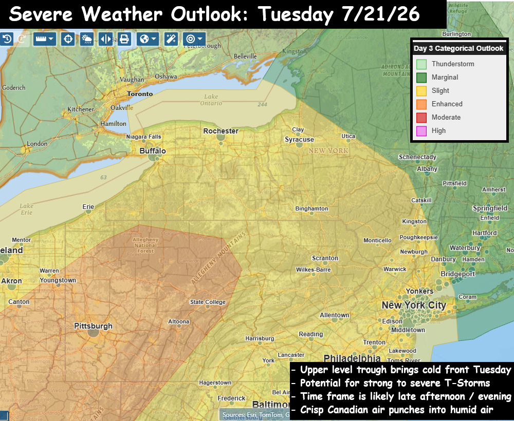
– Humid, w/ Scattered Showers & T-Storms Tuesday PM
– Potential Severe weather event Tuesday Late afternoon / evening
– Slight Risk (15% to 30%) of severe T-storm in Hudson Valley area
An absolutely gorgeous Sunday across the Hudson Valley. Low humidity, no smoke… lots of sunshine, and afternoon highs in the upper 70s. Now we look forward to the week ahead, and we have another upper-level trough digging in for Tuesday, and that appears poised to touch off scattered showers and T-Storms around the Hudson Valley and northeast. We’ll see a southerly flow out ahead of it Monday night into Tuesday. The front has cool & dry air behind it, and that should be enough to touch off a squall line of strong to severe storms late on Tuesday.
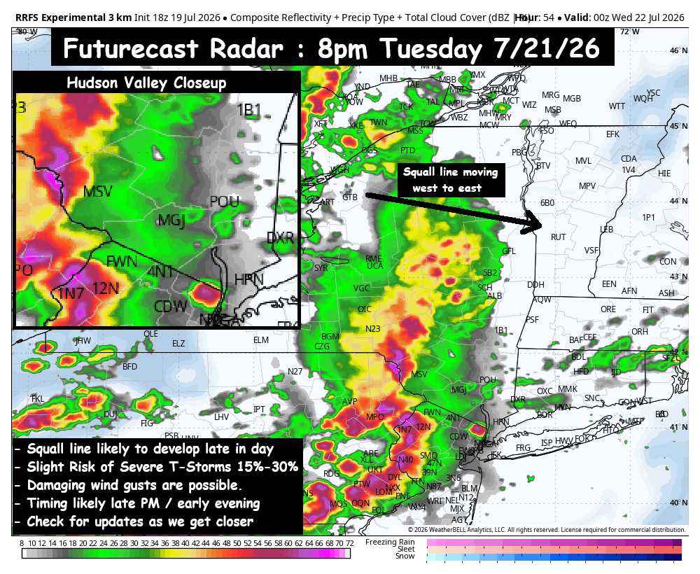
The details will become more clear as we get closer to the event. The timing looks like 4pm to 10pm on Tuesday, and at the moment we have a ‘Slight Risk’ (15% to 30% chance) of a severe T-Storm in the Hudson Valley. The primary risk would be for damaging wind gusts, but with this event over 48 hours away, updates will be very important to focusing in on the details with this event. For perspective on the intensity of this severe weather threat… at the moment, this severe threat does not look as intense as the Saturday severe T-Storm event we just experienced.
We’ll have to watch this closely over the next 48 hours to see if the severe threat rises. We’ll have updates as we get closer. For now, enjoy the beautiful weather.