
Weekend Outlook: Nice Start, But Isaias Remnants Arrive Sunday PM
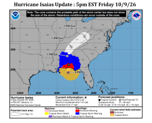
Hurricane Isaias is taking aim on the Gulf coast this evening, expecting to make landfall around Pensacola FL before midnight as a strong category 2
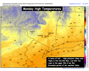
Monday Discussion – Cooler, Feels like Fall
We started with a warm end to the work week, with highs in the mid 80s across portions of the region. But Saturday quickly returned

Nor’easter Lingers and Weakens on Monday
– MONDAY: Scattered rain showers diminishing later in the day. Cloudy and breezy, with diminishing wind. Chilly. High in the upper 50s. – MONDAY NIGHT:

COASTAL STORM UPDATE — AFTER NEARLY 10 DAYS OF TRACKING OUR STORM HAS ARRIVED
COASTAL STORM UPDATE — AFTER NEARLY 10 DAYS OF TRACKING OUR STORM HAS ARRIVED-WAVES OF RAIN, WIND AND A LONG-DURATION WEEKEND EVENT The nor’easter is

COASTAL STORM UPDATE — NOW DEEPENING AND SLOWLY APPROACHING THE REGION
The nor’easter we’ve been tracking is now developing offshore, with surface pressure around 996mb this afternoon and additional strengthening expected tonight as it moves north.

NOR’EASTER UPDATE — THE BIG QUESTION NOW: HOW MUCH OF SATURDAY CAN WE SALVAGE?
The coastal storm we’ve been tracking for nearly 10+ days publicly and even longer behind the scenes is now developing off the East Coast. Major

Unsettled Sunday… Continues into Monday
After a beautiful Saturday… we’ll have a frontal trough pushing into the eastern part of the country. It will spread clouds and scattered rain showers

Sunday Weather Discussion : Increasing clouds & humid.
Another weak upper level trough will interact with a low pressure system over the Ohio Valley, and begin pushing moisture up into the Hudson Valley

HVW Recap : Storm History – Rainfall Totals 7/28 – 7/30
A record-breaking storm for portions of the Hudson Valley is now in the books. Some locations received nearly a foot of rain in less than

Locally Significant Rainfall Possible on Tuesday
Low pressure will move toward the Northeast on Tuesday, and spread rainfall out ahead of it. The upper level trough will capture the system and
The Week Ahead – Upper Low Stalls & Brings Soaking Rain
An upper level trough will dig into the Northeast on Tuesday, and cause a surface low pressure to stall out over parts of the Northeast

Tuesday Weather Outlook : Showers, Downpours & Potential Severe Storms
– Scattered showers develop 7am – 10am… localized downpours – Early PM Scattered showers & Storms… (possibly taper off?) – Potential for Severe T-Storms (highest

Eyes on the Next Weather Maker: Tuesday PM
– Humid, w/ Scattered Showers & T-Storms Tuesday PM – Potential Severe weather event Tuesday Late afternoon / evening – Slight Risk (15% to 30%)

Saturday Outlook : Strong to Severe T-Storm Potential
Smoke has dominated the headlines this week, thanks to large Canadian wildfires sending thick smoke hundreds of miles away to our neck of the woods.

Wednesday PM Canadian Wildfire Smoke Update
The impact of the Canadian wildfires continues to be felt across the Hudson Valley, and likely will be with us for the next 1 to

HVW Work Week Outlook – The Heat Returns
We move into the peak of meteorological summer, and this week it will certainly feel like it. A strong upper level ridge will settle over

Weekend Outlook : Beautiful Weather Returns
Over the last 2 weeks we’ve had record heat, soaking rains and flash flooding. This weekend is looking mainly dry… with temperatures very close to

Rainfall Summary : Sunday 7/5 to Tuesday 7/7
Much needed rainfall over the last couple days, as the entire region saw roughly 1 to 3 inches of rain. But we had stressed the

HVW 12 hour Rainfall Summary : Sun 12pm – Mon 12am
This map may be hard to read… but it tells you what you need to know about the next 24 to 36 hours. This map

Significant Rainfall Event Possible – Monday into Tuesday
– Scattered showers developing late Sunday – Localized pockets of torrential downpours possible A very tricky forecast is shaping up for the Hudson Valley

Holiday Weekend Forecast : Major Changes Coming
The Hudson Valley is locked in the midst of an intense heatwave. Poughkeepsie set a record high of 103° on Thursday, and then on Friday