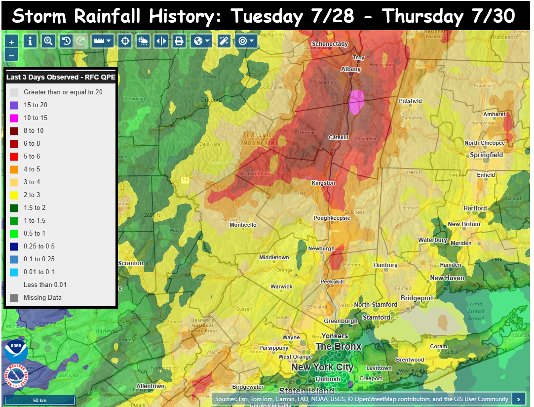
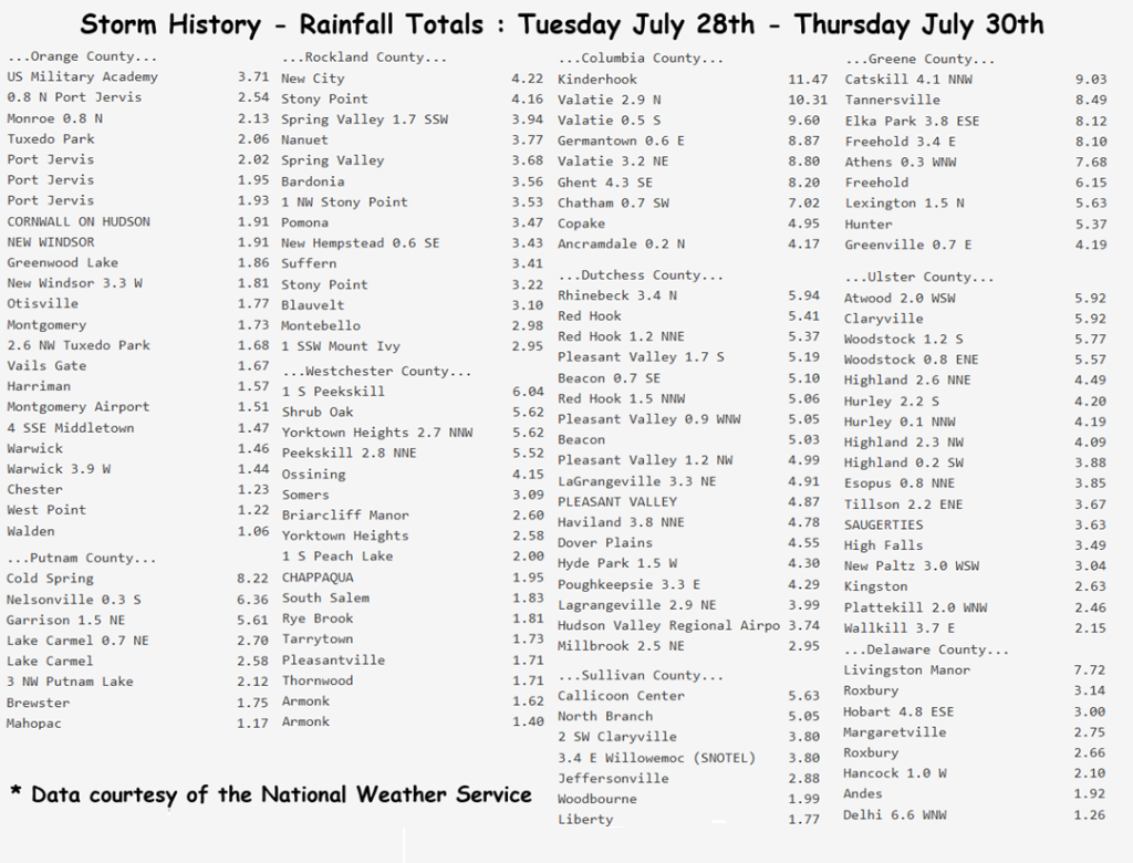
A record-breaking storm for portions of the Hudson Valley is now in the books. Some locations received nearly a foot of rain in less than 24 hours, causing severe flash flooding in parts of Columbia, Greene, Rensselaer, and Albany counties. Highest rainfall totals in our area include:
– Kinderhook: 11.47″ – Valatie: 10.31″ – Catskill: 9.03″
– Germantown: 8.87″ – Tannersville: 8.49″ – Cold Spring: 8.22″
We tracked this storm for several days and tried to highlight the complexity and potential severity of the situation. That a slow-moving low pressure would be captured by an upper-level trough, causing the low pressure to stall out. That when the storm stalled, the area of rainfall would also stall… and begin to pivot over the same locations, for many hours. This would likely result in an area of torrential rainfall with totals over 6″ possible… and even discussed that some guidance suggested localized pockets of 10″ of rain.
The trouble is that we couldn’t pinpoint exactly where this would happen. We felt strongly that it would be somewhere in eastern NY or western New England. Current technology cannot pinpoint where bands of excessive rainfall will occur, but we can forecast general regions with some degree of accuracy, so that’s what we try to do at HVW. We tried to drive home the idea that we’re all going to see a soaking rainfall… but that within our area, some areas are likely to receive excessive (potentially flooding) rains. Our goal is to provide viewers with the information needed to make informed decisions, to hopefully save time, money, property and most importantly… lives.
We hope everyone made it through the storm safely, and remains safe during the cleanup in the heavily impacted areas. Please feel free to share images and local reports in the comments below. Please be aware that the data from the National Weather Service offices may be incomplete. Thank you all for your continued support!