
Low pressure will move toward the Northeast on Tuesday, and spread rainfall out ahead of it. The upper level trough will capture the system and cause it to stall out for several hours Tuesday night into Wednesday. This is expected to cause the rainfall to slow down as well, and the Hudson Valley could see several hours of locally heavy downpours.
Rainfall totals between 2 and 4 inches are possible, with locally higher totals possible where the heavy downpours persist the longest (Image #1 above). Some guidance suggests upwards of 5 or 6 inches in a few isolated areas. The biggest challenge continues to be exactly where this area of heaviest rainfall will be. As the low pressure slows down… the rain should begin to pivot over the same areas, and that could result in excessive rainfall.
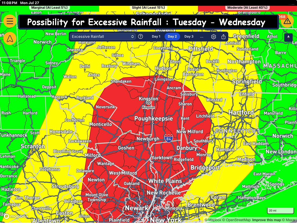
(Image #2) shows where the highest chances of excessive rainfall are… with the best chances being over portions of the Hudson Valley (roughly 40%). But there is other guidance that suggests the heaviest rainfall could be over parts of CT and MA. For this reason, a Flood Watch is in effect for the entire region.
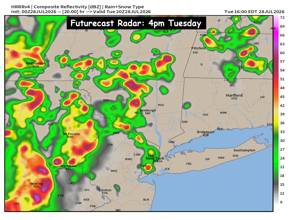
(Image #3) shows the heavier scattered showers, T-Storms & downpours develop between 2pm and 6pm. So as the afternoon continues, conditions are expected to deteriorate. The bands of heavier rain are expected to pivot between 6pm Tuesday and 6am Wednesday. During that time, is when the highest risk for excessive rainfall and flooding will occur. We’ll have to monitor the situation closely as it develops on Tuesday.
For additional thoughts on this system, you can also refer to our post from Sunday night: https://www.facebook.com/share/p/198v9grEGK/
A complex system will impact our area on Tuesday. Grab the rain gear and keep an eye out for updates on Tuesday.