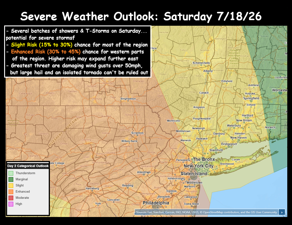
Smoke has dominated the headlines this week, thanks to large Canadian wildfires sending thick smoke hundreds of miles away to our neck of the woods. But our eyes turn to a new threat for Saturday… as we have showers and T-Storms poised to move into the Hudson Valley.
Summary:
– Slight to Enhanced Risk (15%-45%) of Severe T-Storms in our area
– Severe threat highest between 6pm and 10pm
– First wave of showers & T-Storms 10am to 2pm
– Squall line of severe T-Storms arrives 6pm to 10pm
– Damaging wind gusts biggest threat, isolated tornado & hail possible
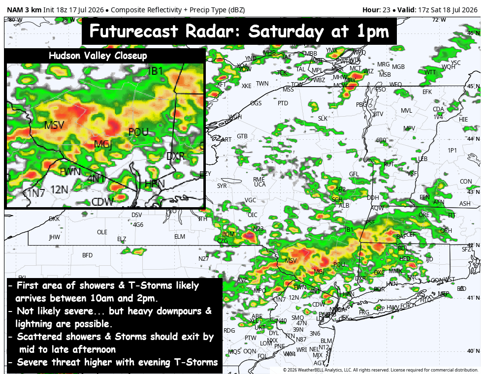
Low pressure in southern Canada will swing a cold front through NY state later on Saturday. The trough digging in will likely touch off areas of showers and T-Storms during the late morning into early afternoon hours. The longer the first wave of rain showers and clouds persist… the more stabilized the atmosphere should be later in the day on Saturday, which would lower the severe threat. Something we’ll be watching closely during the day.
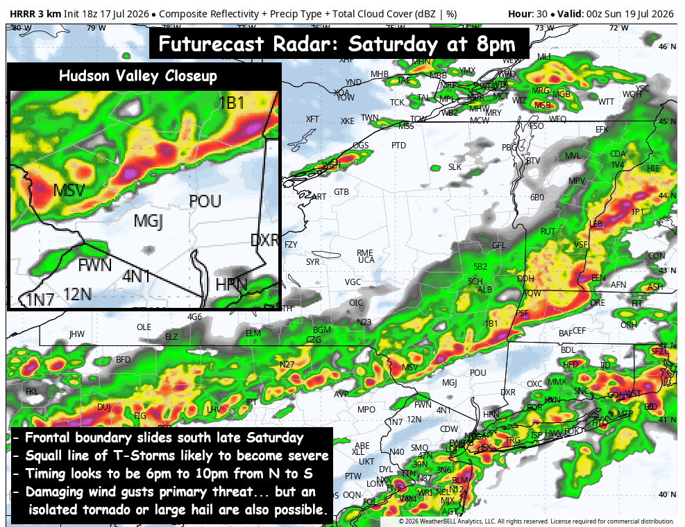
The squall line associated with the cold front looks like it could pack a punch. The highest threat appears to be further north and west of our area, but the Hudson Valley is on the border of Slight (15% to 30%) and Enhanced Risk (30% to 45%). Those ranges represent the likelihood of a severe T-Storm in the Hudson Valley. The squall line appears likely to reach the Catskills & Upper Hudson Valley between 6pm and 8pm… and push southward during the evening. Strong wind gusts, frequent lightning, and heavy downpours are likely… and those gusts could exceed 50mph and be severe (30% to 45% chance). We can’t completely rule out an isolated tornado (roughly 5% chance). Conditions should gradually improve, with showers & storms tapering off around midnight.
We’ll be monitoring this very closely over the next 24 hours, so be sure to check back for updates Saturday morning…