
An upper level trough will dig into the Northeast on Tuesday, and cause a surface low pressure to stall out over parts of the Northeast Tuesday into Wednesday, and the result could be a significant rainfall for parts of the region.
– Scattered rain showers develop Tuesday afternoon
– Bands of rain and areas of downpours likely stall out Tuesday night.
– Some areas could see several hours of heavy rain into Wed AM
– Low pressure loops, and pulls away Wednesday night
– Wide range of rainfall possible: 1″ to 4″+
A tricky system will impact the region on Tuesday… with characteristics more typical of an autumn storm. The jet stream will buckle just a bit over the northeast, allowing an upper level low pressure to capture a weak surface low pressure late on Tuesday… and cause it to nearly stall out for several hours, before finally moving away Wednesday evening.
Areas of scattered showers and even a few thunderstorms likely develop Tuesday afternoon (especially in the western HV). Those rain showers and embedded downpours will slow down, and should stall for several hours, before slowly pivoting around… and pulling to the east. The big questions are:
– exactly where does this low pressure track?
– where does it stall out?
– and how quickly does it pull away?
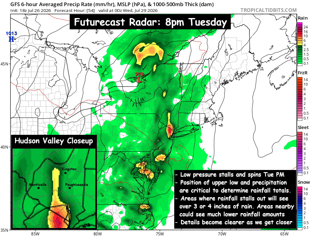
Where the showers and downpours stall or slow down… heavy rainfall totals are possible. Some guidance suggests that over 4″ or 5″ of rain could fall in some locations… while areas just outside of those stalled bands of rain, could see 1″ or possibly less.
– Some guidance says this will happen just to our west, putting the highest rainfall totals over PA and central NY.
– Some guidance says this will happen just to our south, dropping over 5″ in NJ, while areas from I-84 on north see only an inch.
– Much of the guidance says this will happen over parts of our area, the question is “which part of the region?”
The current forecast is for 2″ to 4″ over much of the Hudson Valley, with some localized areas possibly breaking 5″. The storm should gradually pull east Wednesday night, into Thursday morning. Conditions should begin to dry out Thursday, hopefully with some breaks of sun returning. But these upper level low pressure systems can be tricky to forecast, so we’ll have to wait and see how things unfold, and share updates about how quickly we expect conditions to improve.
We’ll have to watch this closely to see how the details unfold. We’ll have more updates as we get closer.