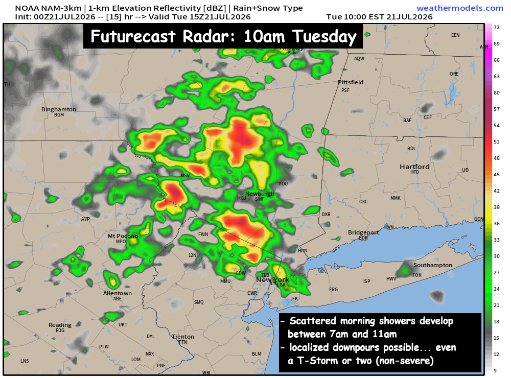
– Scattered showers develop 7am – 10am… localized downpours
– Early PM Scattered showers & Storms… (possibly taper off?)
– Potential for Severe T-Storms (highest 5pm to 9pm)
Two gorgeous days around the region between Sunday and Monday… and now we’ll watch as the winds shift out of the south for Tuesday and allow moisture and humidity to return to the Hudson Valley. Scattered showers are expected to develop between early and mid morning on Tuesday… and some of the showers could produce locally heavy downpours. The scattered showers & T-Storms during the late morning and early afternoon are not expected to be severe… but we could see some localized heavy rainfall totals from those storm cells.
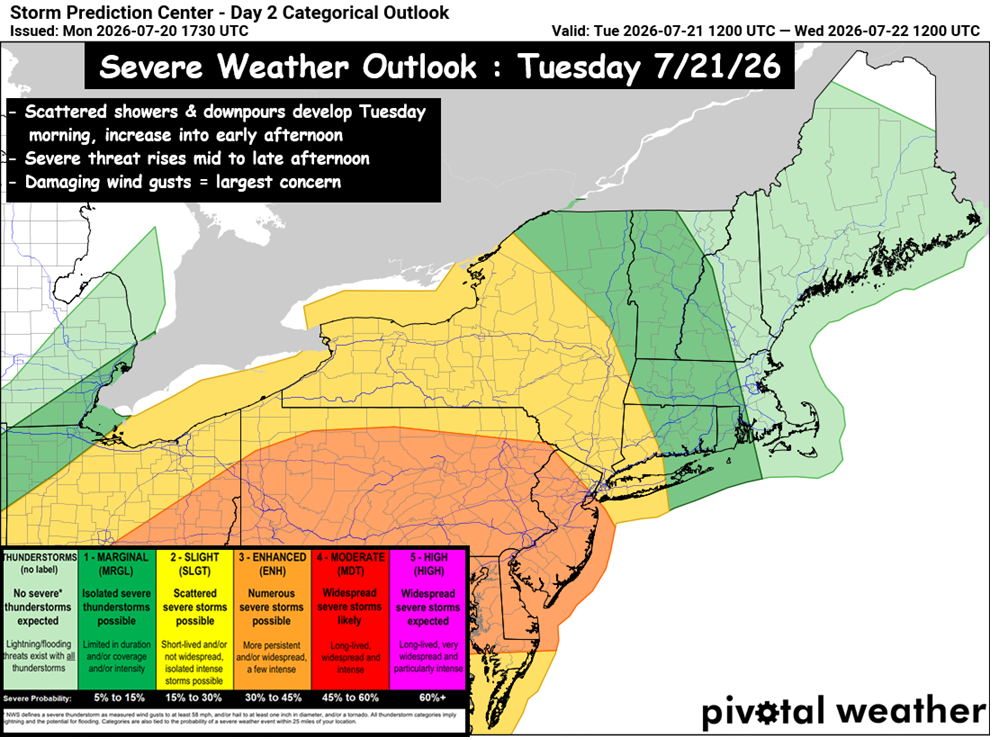
The severe threat comes later in the day, with the approach of another cold front. Mild and humid air will be in place Tuesday… with highs in the mid to upper 70s, and dew points in the low to mid 70s. A digging trough into the northeast will usher another batch of cool… crisp, dry, Canadian air for the 2nd half of the work week.

The clash of these two air masses has the potential to kick off severe T-Storms. The region remains in a “Slight Risk” with roughly a 15% to 30% chance of a severe storm in our area… but just to our SW is an “Enhanced Risk” of 30% to 45% chance of a severe storm. The line could develop between 5pm and 7pm, and push SE around sunset. One thing that could work in our favor, is the extended scattered showers & downpours during the day may stabilize the airmass over our area… and could help to reduce the severe threat. This is something we’ll watch closely, and update as things develop.
Another busy day shaping up on Tuesday. Be sure to pack the umbrella, and plan for unsettled weather. Have a great start to your day!