A frosty start to our Saturday morning across the valley… resulted in a cool, if not brisk Saturday afternoon around the valley. High temperatures Saturday afternoon were in the low 60s, but a persistent breeze made it feel like the 50s all day. As we look to Sunday, we’ve got some major changes in store…

SW winds will bring the afternoon temperatures on Sunday well into the 70s across the valley. We should see the sunshine mixing with clouds through the late morning and early afternoon. However some guidance suggests we may have some late day scattered showers and T-Storms to contend with.
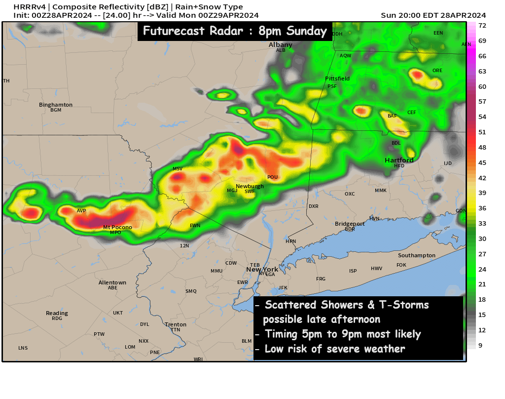
A weak trough may sneak into the Hudson Valley and Northeast Sunday afternoon, and it could touch off a few showers and T-Storms. The HRRR model brings a line of showers and storms around sunset… but the NAM model is less impressed with the atmospheric instability. The good news right now, is that we don’t anticipate any of these T-Storms to become severe. We’ll be watching this through the day, and let you know if the line of showers and storms develops. But for planning purposes, it’s best to plan for this rain and T-Storm threat late in the afternoon and near sunset.
However, after a chilly Saturday… both Sunday and Monday look to bring a late spring or early summer preview to the Hudson Valley. Highs in the mid to upper 70s… possibly hitting 80° in some areas… more typical of mid to late May. Hopefully you can enjoy the warmth!