We started with a warm end to the work week, with highs in the mid 80s across portions of the region. But Saturday quickly returned to seasonable temperatures, and gave us a rather nice weekend… aside from a extra clouds on Sunday.
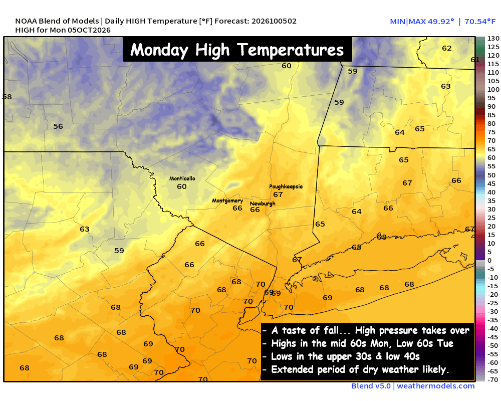
So as we look forward to the first full week of October, expect an extended stretch of high pressure. We’ll have a few troughs trying to dive in from Canada through the week, but at this time it looks like the high pressure will prevent much moisture from reaching the Hudson Valley this week.
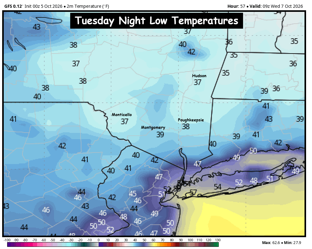
The big story will be the fall chill on both Monday and Tuesday nights. With cooler, Canadian air in place for the start of the week, the nights will get quite chilly. Clear skies and calm winds should allow overnight lows to fall near 40° in the Hudson Valley… with some colder spots dropping into the upper 30s. It doesn’t look like this air mass will be cold enough to get any areas of frost… but it’s something we’ll watch. Our guess is that we’ll have to wait for another cold front to get the first frost of the season in the Hudson Valley.
Monday: Clouds mixing with sun, a stray sprinkle. Breezy and seasonable. High in the mid to upper 60s.
Monday Night: Partly cloudy skies, turning clear overnight. Calm winds. Low in the low 40s. Patchy areas of upper 30s possible in colder spots.
Tuesday: Mostly sunny and cool. High in the low to mid 60s.
Tuesday Night: Mostly clear and very chilly. Low around 40°, with some upper 30s.
The next shot at rain looks likely to be next weekend possibly. So for now, enjoy the beautiful taste of fall weather.