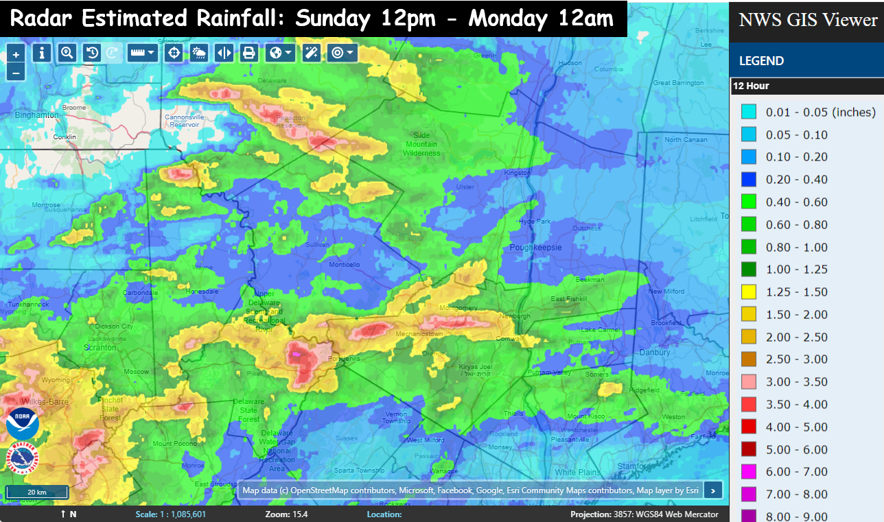
This map may be hard to read… but it tells you what you need to know about the next 24 to 36 hours. This map shows the radar estimated rainfall totals from 12pm Sunday through midnight… a 12 hour period. The key is on the right side of the graphic. It shows the entire region has seen at least a tenth of an inch of rain. The areas in green are locations that have seen half an inch in the last 12 hours. Where you see yellow… it’s roughly 1 to 2 inches. The orange is where they’ve seen 2 to 3 inches already… and the pink and red is where anywhere from 3 to 5 inches of rain has fallen… ALREADY.
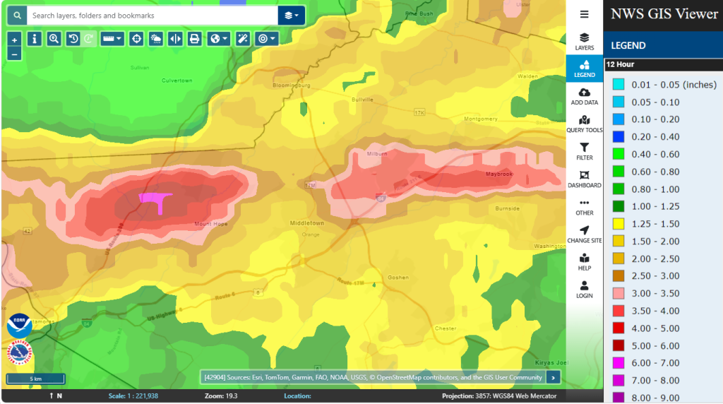
Notice how the torrential rainfall areas are very narrow… and hit or miss. You’ve got an area in the Catskills that we talked about this afternoon. Then there are 2 pockets in Orange county. One pocket of 3 to 5 inches of rain that has fallen near Mount Hope and Otisville… then another pocket east from roughly the Galleria at Crystal Run… east to Maybrook.
This will mean we’ll have pockets of much higher rainfall totals than surrounding areas. So be on guard for flash flooding potential. We will share the alerts as quickly as we can. Stay dry friends…