Low clouds and drizzle associated with a stalled frontal boundary have parked themselves over the Hudson Valley and eastern NY.
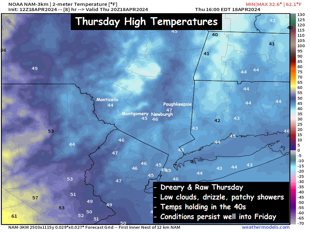
The radar doesn’t tell the story, because the low clouds and drizzle don’t really register on radar… but a persistent mist along with a few steadier rain showers will linger throughout the day on Thursday. The low level moisture will keep temperatures pinned in the 40s across the valley, roughly 15 to 20 degrees below average for this time of year. Not the nicest of days by mid April standards.
These conditions will be with us into Friday as well, with conditions improving a bit Friday morning. A few breaks in the clouds are possible, and temperatures should climb into the 50s. But a new approaching frontal boundary will bring a chance of more widespread, heavier rain showers around mid day to early afternoon on Friday. Not a washout, but you’ll have to factor the shower threat into your afternoon plans.
Make sure you have the heavy winter coat handy for today. The chill in the air will remind you of late February or early March. Have a great afternoon!