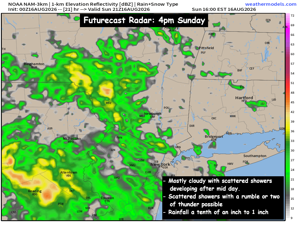
After a beautiful Saturday… we’ll have a frontal trough pushing into the eastern part of the country. It will spread clouds and scattered rain showers into NY and the Northeast. The scattered showers should reach the Hudson Valley between 12pm and 6pm… earlier west of the Hudson River. The precipitation shield looks to be disorganized and weak… so the showers should be mainly light and scattered in nature. The scattered rain showers could also contain a rumble or two of thunder… but we do not currently expect any storms to become severe. The clouds and scattered showers will keep temperatures in the upper 70s to near 80° for highs.
The clouds & scattered rain showers will be with us through much of the evening hours, before the precipitation moves to our south and east. It’s possible that another band of scattered showers and T-Storms develops Monday afternoon, something that will need to be monitored. Highs on Monday should climb into the low and mid 80s.
Make sure you keep the umbrella handy for the afternoon hours, as the moisture gradually creeps in from west to east. We’ll share updates as appropriate… Have a great day!
-Bill