We move into the peak of meteorological summer, and this week it will certainly feel like it. A strong upper level ridge will settle over the middle of North America, and allow heat to overtake the pattern once again. It will also keep the eastern half of the US dry, under a dome of high pressure.
– Monday… Sunshine and blue skies will mix with some fair weather clouds. Humidity looks to be on the low/moderate side. So “real feel” temps should be close to the air temperature. High in the mid 80s.
– Monday Night… Partly cloudy and mild. Lows in the mid 60s.
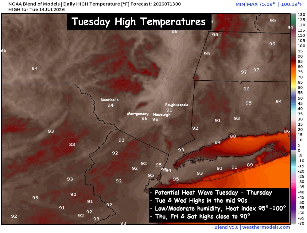
– Tuesday… Mostly sunny and hot… not too humid! High in the mid 90s. Low to moderate humidity, should keep heat index values 95° to 100°.
– Wednesday… Mix of clouds and sun… hot but with low humidity. High in the mid 90s. Heat index in the mid 90s.
– Thursday… Sunshine mixing with clouds… not as hot. High around 90°. Low humidity… making for heat index in the upper 80s to near 90°.
Poughkeepsie Record Highs:
Tuesday : 99° ; Wednesday : 98°
Tuesday and Wednesday look impressively hot. Highs both days should climb well into the 90s. We do have a shot at record highs this week, but we’ll likely be a degree or two short each day. But this heat wave won’t be nearly as humid as the one two weeks ago. A weak NW flow should develop mid-week, and it should push drier air (less humid) into the Hudson Valley by Wednesday and Thursday. It may not provide much relief from the heat… but it should help us avoid oppressive heat index values this week. Tuesday is likely to be the most uncomfortable, before less humid air arrives on Wednesday… and by Thursday the air mass looks a few degrees cooler.
Prepare for another hot week across the Hudson Valley. At least the humidity won’t be oppressive like the last heat wave. We’ll share updates as we go. Stay cool!