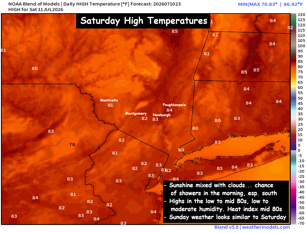
Over the last 2 weeks we’ve had record heat, soaking rains and flash flooding. This weekend is looking mainly dry… with temperatures very close to average for this time of year… for most locations, it should be a stellar weather weekend.
Saturday … Clouds are likely to start the morning, especially for the lower half of the valley. A small area of showers and embedded downpours are possible near sunrise (mostly south of I-84), but they should diminish before noon. The afternoon should see a mix of clouds and sun, with highs 80° to 85°. An isolated shower can’t be ruled out here or there.
Saturday Night… Mostly clear skies and mild. Low in the low to mid 60s.
Sunday… Sunshine mixing with clouds, seasonable temperatures and mainly dry. High in the low to mid 80s. Humidity levels low/moderate and real feel temps in the mid 80s.
A LOOK AHEAD…
Next week we’re looking at the potential for another brief heatwave, as a ridge of high pressure builds again over the eastern half of the US. The ridge will not be long lasting, but it will be strong enough to get highs near or above 90° on Tuesday, Wednesday and Thursday. This heat wave looks NOTHING like what we saw at the start of the month, but it could be hot enough to impact your outdoor plans.
But the heat wave likely breaks on Thursday or Friday, when a frontal boundary slides south from Canada. That should bring us cooler temps NEXT weekend, with afternoon highs around 80° and overnight lows in the 50s.
We’ll track the potential for AM showers on Saturday, the best chance appears south of I-84. But otherwise, the weekend weather looks excellent for outdoor activities! Have a great start to your weekend!