A blustery start to the work week across the Hudson Valley, thanks to a passing upper level low pressure system, which will bring strong NW winds Sunday night into Monday. Gusts between 30mph and 50mph are possible around the region. Make sure you plan accordingly and secure any loose outdoor items that may blow away.
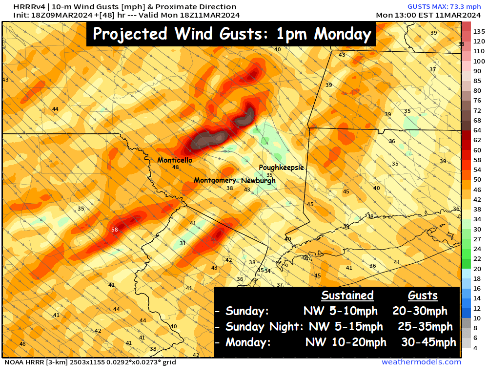
These winds on Monday will also add quite a chill to the air. Morning temperatures on Monday are expected to be in the upper 20s and low 30s… but with gusts over 30mph expected, that will give us wind chills in the teens and 20s to start the day on Monday.
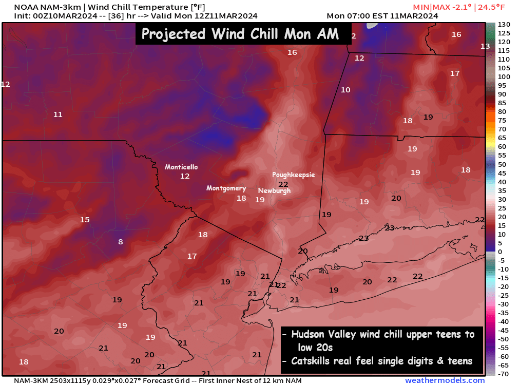
Our afternoon highs on Monday will climb into the mid 40s… but with howling NW winds gusting over 30 to 50mph… afternoon wind chills will be held down in the mid 30s. Our start to the work week will be a blustery and cold one.
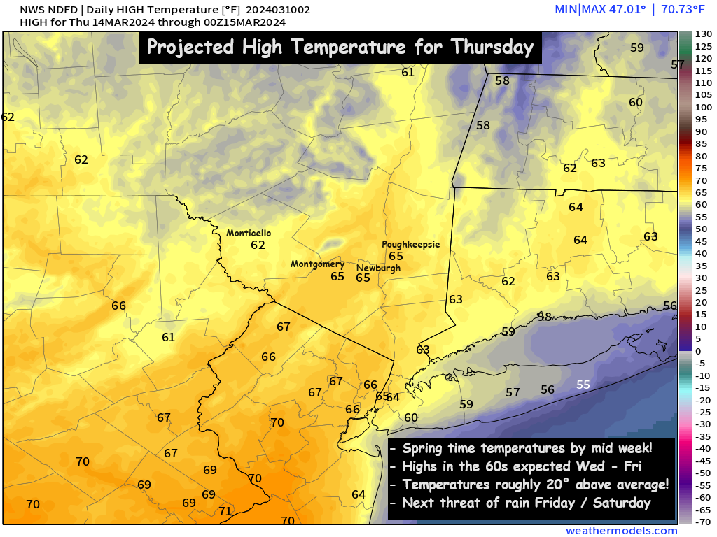
However… it will be short lived, as SW winds will return quickly on Tuesday, and we’ll watch temperatures spike into the mid and upper 50s on Tuesday, and then likely into the 60s on Wednesday, Thursday and Friday… possibly hitting 70° in some places on Thursday!! Some of the warmest temperatures we’ve seen in months. Those looking for a spring preview will be very happy with the weather by mid week.
But for Monday, be sure to bundle up… because winter isn’t giving up just yet. Have a great start to the week!
-Bill