Precipitation associated with our next system will move into the region from west to east early tomorrow morning between 3am and daybreak. Initially some of this precip may start off as a period of wet snow across the Catskills, this will be limited to elevations above 1500’ with the rain/snow elevation line rising by daybreak. Showers and periods of steady rain will persist through much of the day before tapering off from west to east between 6-10PM.
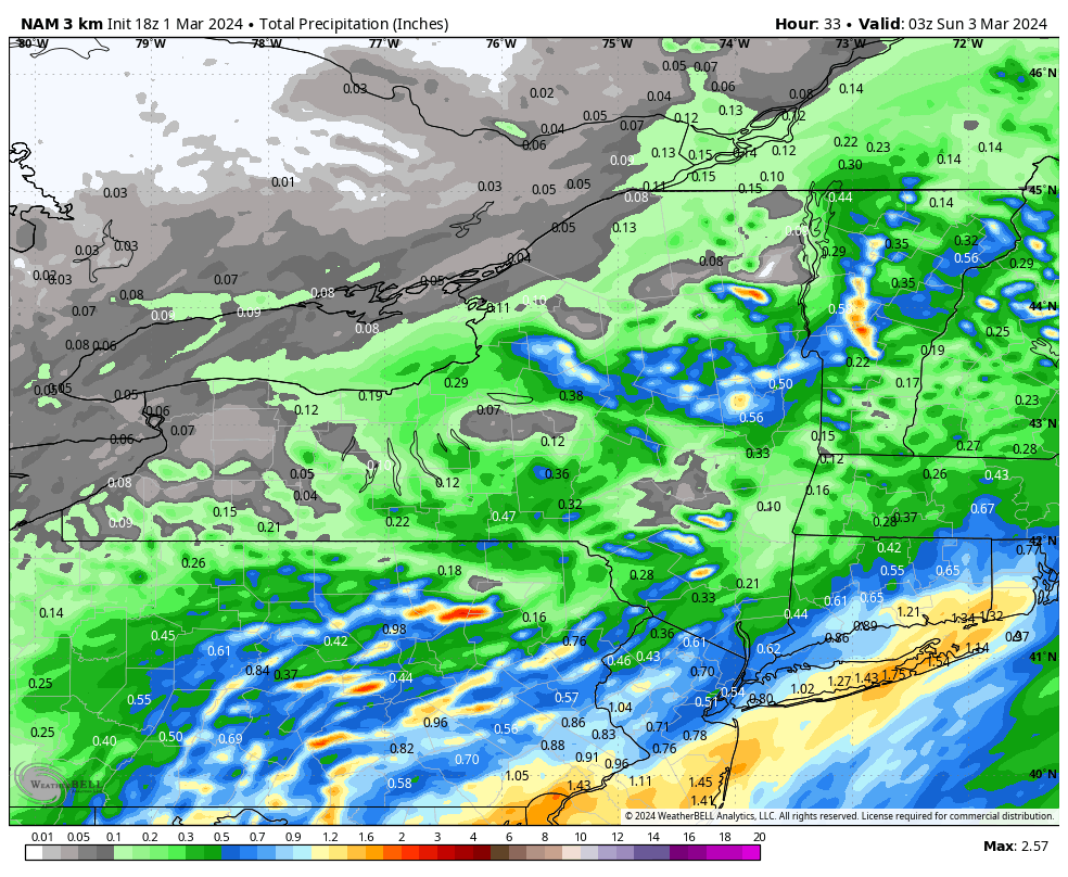
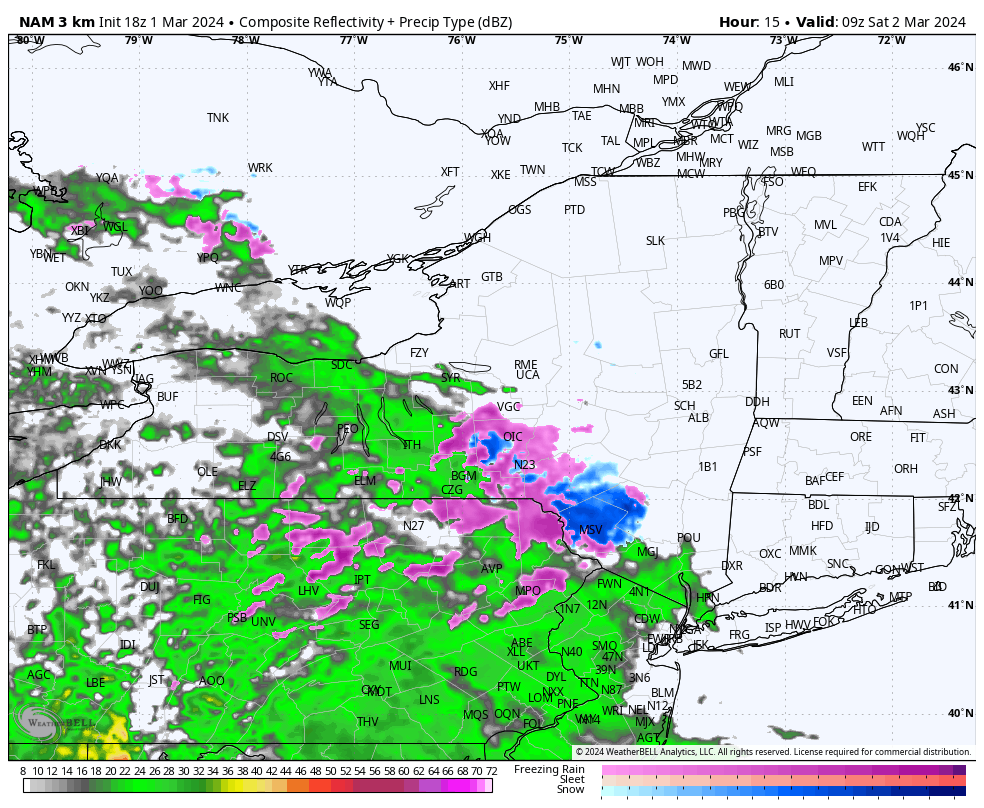
Here’s a look at projected rainfall amounts and what the radar may look like tomorrow before daybreak. Rainfall amounts will be heaviest across SW parts of the region where .40-.60” may fall and lightest across NE parts of the region where rain may be a bit slower to start, where .20-.30” may fall.
Now for the silver lining, once we get through a dismal Saturday we look to pull out a decent Sunday with partly sunny skies and temps pushing into the upper 50’s with the exception of the Catskills where clouds and cooler temps may be a bit more stubborn. Here’s a look at projected temps for Sunday.