Seasonable Sunday, but Warm Air on the Way…
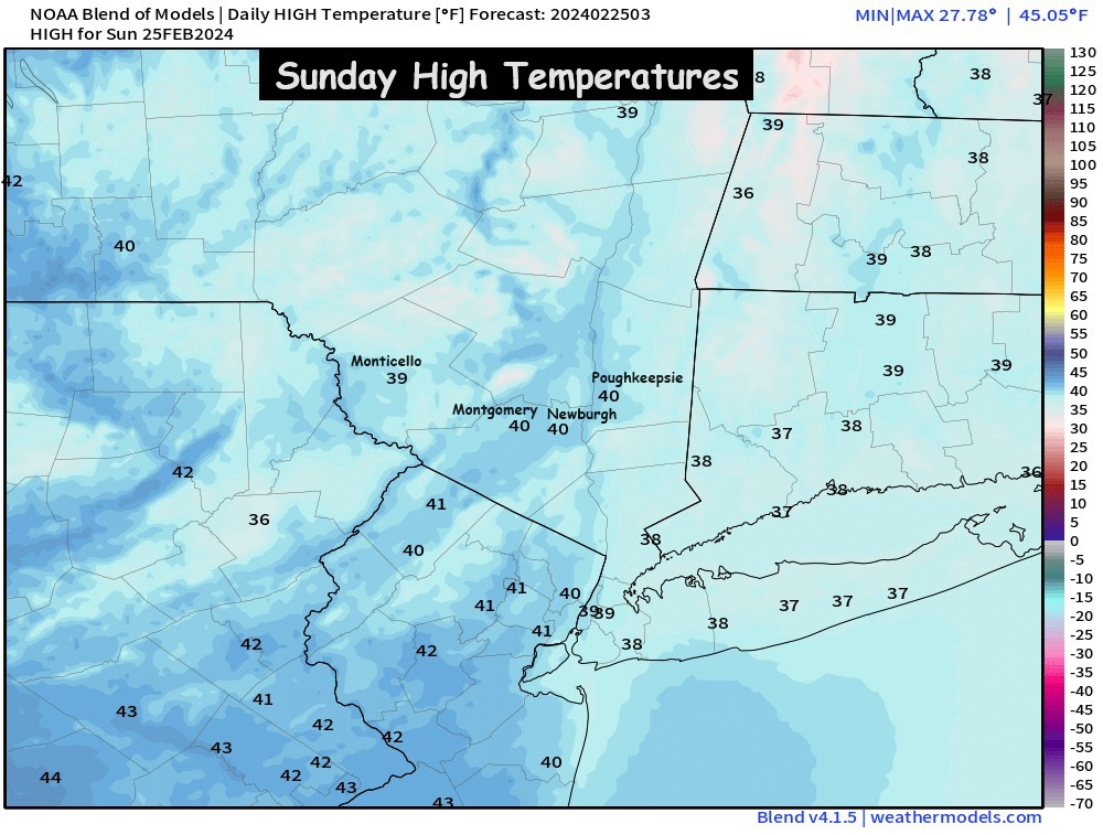
We’ll have sunshine to start our Sunday in the Hudson Valley, but we’ll watch as clouds increase through the afternoon hours. Highs on Sunday should be in the upper 30s to low 40s. Then temps will fall near freezing Sunday night… and a very weak frontal boundary will drift through the region. It could touch off a few scattered rain or wet snow showers around the Monday AM commute. Even a few areas of freezing drizzle are possible, so we have some minor concerns about icy spots Monday morning. We’ll monitor the threat through the day on Sunday and provide an update Sunday night, so you can prepare for the Monday AM commute.
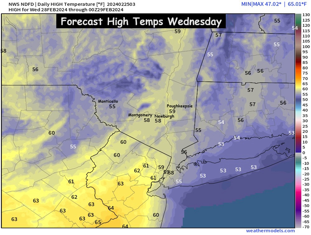
However, behind the warm front on Monday, temperatures will jump quickly… pushing 50° Monday afternoon. Then an early taste of spring on Tuesday and Wednesday, with temps in the mid to upper 50s expected… thanks to the upper level ridge returning. Some scattered showers are possible on Wednesday and Wednesday night… possibly ending as a bit of snow before we have a cold end to the work week.
A possible slick start to the work week, followed by milder temps. We’ll have updates along the way. Also, the website may be down for a bit on Sunday as we continue to make upgrades. Have a great Sunday!
Bill