Another storm system quickly marching across the country from west to east, will spread rainfall across the Hudson Valley Saturday afternoon.
Timing:
– 12pm to 4pm : rain develops from west to east (wet snow possible above 1500 feet)
– 6pm to 12am : heaviest rain expected
– 12am to 6am : rain ends from SW to NE
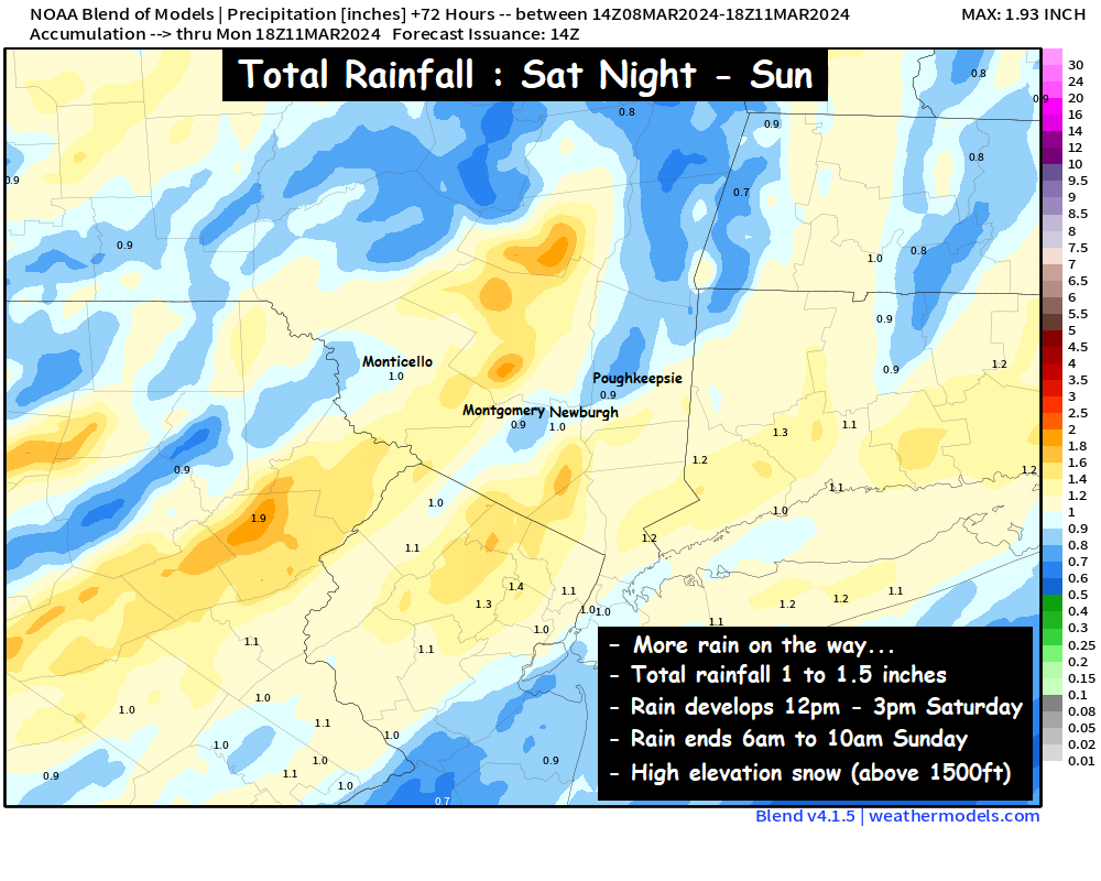
Impacts:
– Between 0.5 and 1.5 inches of rain expected
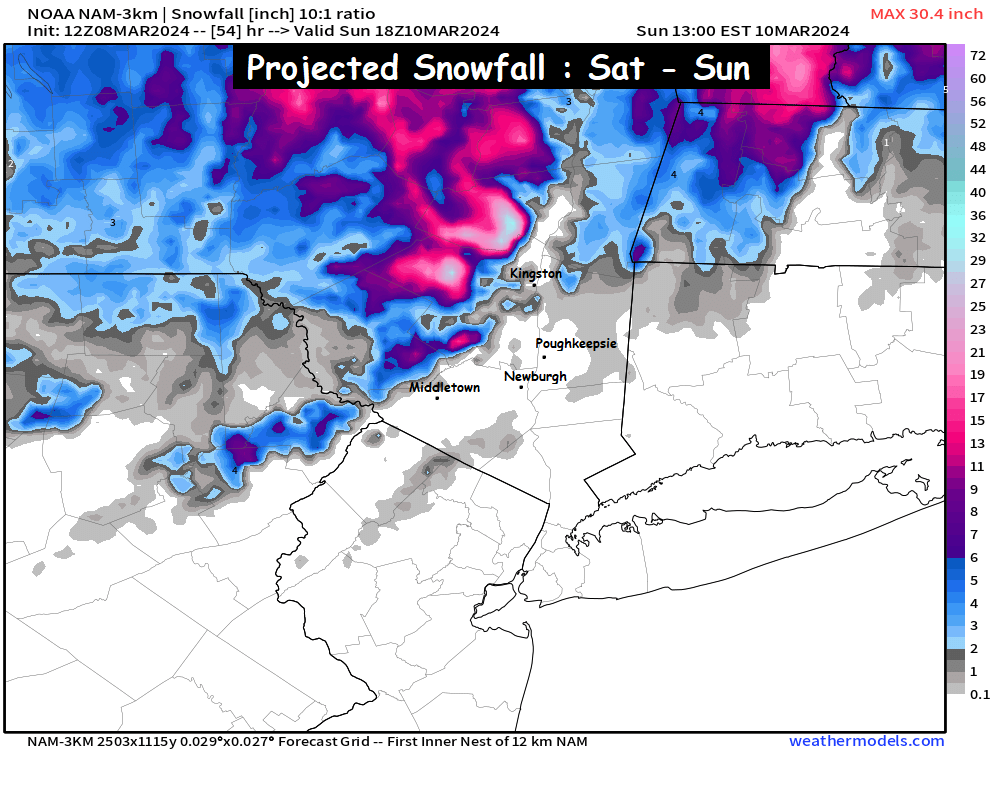
– Catskills could see wet snow accumulation of 3 to 6 inches (especially above 1500 feet)
Rain will develop Saturday afternoon, as early as 12pm near the NY/PA border, and as late as 3 or 4pm near the NY/CT border. Temperatures at the onset of precipitation are expected to be in the mid to upper 30s across the valley, Rain could mix with sleet and wet snow at the onset, especially in the higher elevations. The Catskills, and areas above 1500 feet could stay wet snow for several hours and see several inches of accumulation with temperatures in the low to mid 30s.
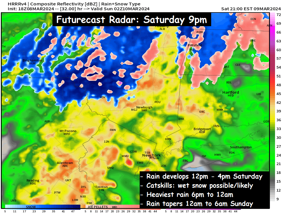
The heaviest rain likely falls between 6pm and 12am, as the area of low pressure passes very closely to NYC shortly after midnight. The precipitation should taper off before sunrise on Sunday. By the time it does, around 1 inch of rain is common… with some areas slightly less, and some locations up to 1.5 inches. This could cause some stream and river flooding around the region, especially in the Catskills. With regard to the Catskills… some guidance suggests that snowfall accumulations of several inches are possible. But you can clearly see that the valley areas are almost entirely rain… with temperatures expected to be in the upper 30s across most valley areas.
We’ll have to watch things closely as we go through the day on Saturday. Expect more updates as we get closer.
-Bill