Current Radar as of 5pm Saturday
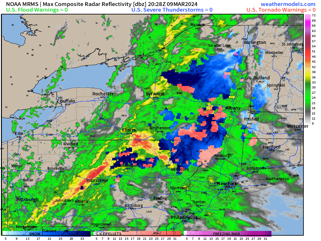
Rain is pushing through the valley, and areas of light to moderate rain are falling as of sunset on Saturday. Some wet snow is mixing in across the Catskills, with temperatures in the mid 30s. 2 to 5 inches of wet snow are possible are possible above 1500 feet in the Catskills. Even there, the wet snow should change to rain as the mid level temperatures warm above freezing.
The Next 6 Hours…
A gap in the precipitation due to some dry air, is pushing NE into northwest NJ, NE PA and soon to be the Lower Hudson Valley. This will likely cause rainfall to taper to light rain showers and drizzle between 5:30 and 7:30pm across the region. But we do anticipate the radar to fill back in behind the area of dry air… and periods of moderate to heavy rain should re-develop between 7 and 9pm across the Hudson Valley. Then moderate to heavy rain is expected to until midnight or so. 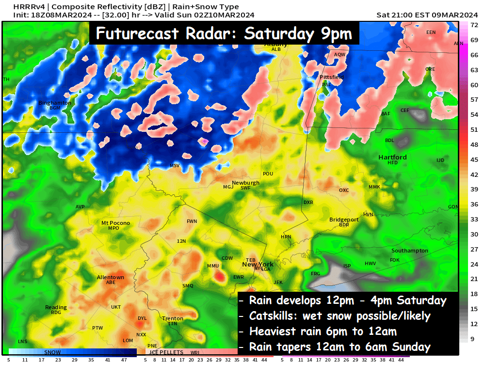
The rain pushes NE rapidly around midnight, and shortly after midnight the rain is projected to taper off…
Futurecast Radar : 2am Sunday
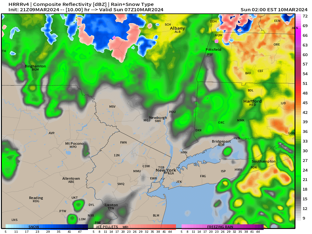
The rain should taper off between 12am and 3am from SW to NE. From there we could see a few scattered rain showers or wet snow showers… as temperatures fall into the mid and upper 30s overnight. Total Rainfall still remains projected around 1 inch on average, with some locally higher amounts possible. That’s why the region is under a Flood Watch.
Then on Sunday we’ll see winds increase out of the northwest… giving us a blustery and cold Sunday afternoon into Monday.
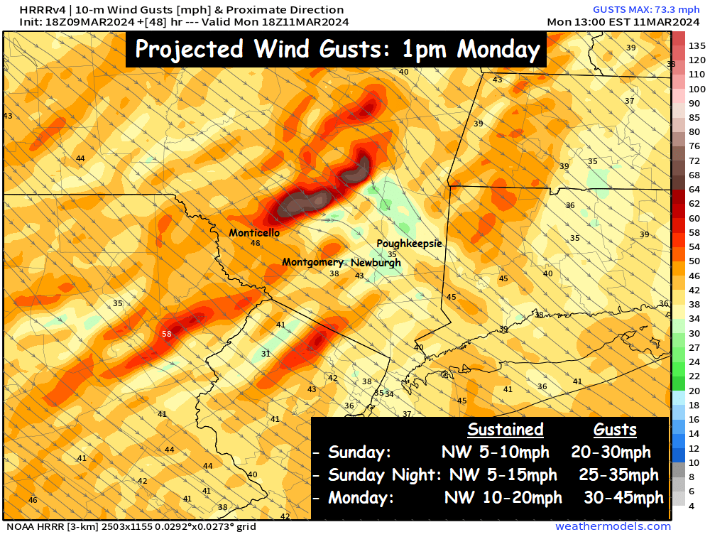
Sunday afternoon wind gusts at 20 to 30mph, combining with temps in the low to mid 40s, to generate wind chills in the 30s. Sunday night, temps fall into the upper 20s and low 30s… resulting in wind chills in the in the teens and 20s. Monday looks blustery and cold, with highs in the upper 30s to low 40s… and wind chills in the 20s. More updates as we move through the evening…