A chilly and rather raw Saturday will transition to a mildly warm Sunday afternoon across the Hudson Valley. The downside is that the warmer temperatures may come with the threat of strong to severe late day T-Storms.
Sunshine will mix with clouds early on Sunday… but clouds will advance again by late morning. Late morning through early afternoon are likely to be mostly cloudy with a few scattered showers possible. The key to the forecast is what happens after that. Much of the guidance suggests that the clouds give way to increasing sunshine between 2pm and 4pm on Sunday… which would give us several hours of sunshine. That sunshine would work with strong SW winds to warm temperatures quickly from the low to mid 50s around lunch time… to the upper 60s and low 70s by late afternoon. If that happens… our radar could look very unsettled as sunset approaches…

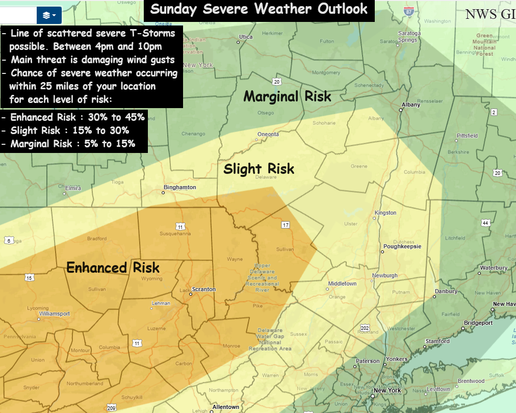
Some guidance is suggesting a severe squall line sets up and takes aim on the Hudson Valley between 5pm and 10pm (peak risk around 7pm to 8pm). If the atmosphere destabilizes due to the afternoon sunshine… T-storms will likely develop and spread across our area. Damaging wind gusts are the biggest threat… with a 30% chance in the Enhanced area… a 15% to 30% chance of occurrence is likely for the rest of the region.
We’ll have to watch as we go through the day, and see if the skies remain mostly cloudy… or if the skies clear early in the afternoon. If the clouds hold on longer than expected, the atmosphere may stabilize and cause the squall line to be weaker than projected. Check back Sunday afternoon for updates on the situation.