A very raw and windy Wednesday shaping up for the Hudson Valley…
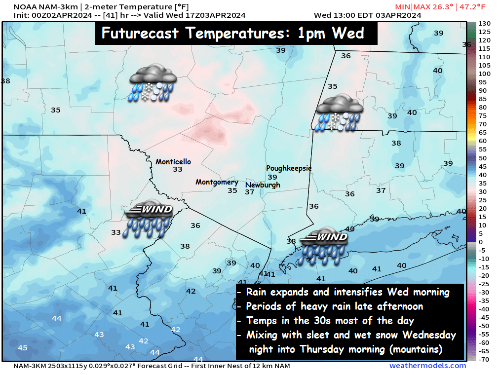
A low-pressure system near Chicago has stalled out but has sent waves of moisture eastward toward the Hudson Valley and northeast.
Futurecast Radar : 6am to 8pm Wednesday
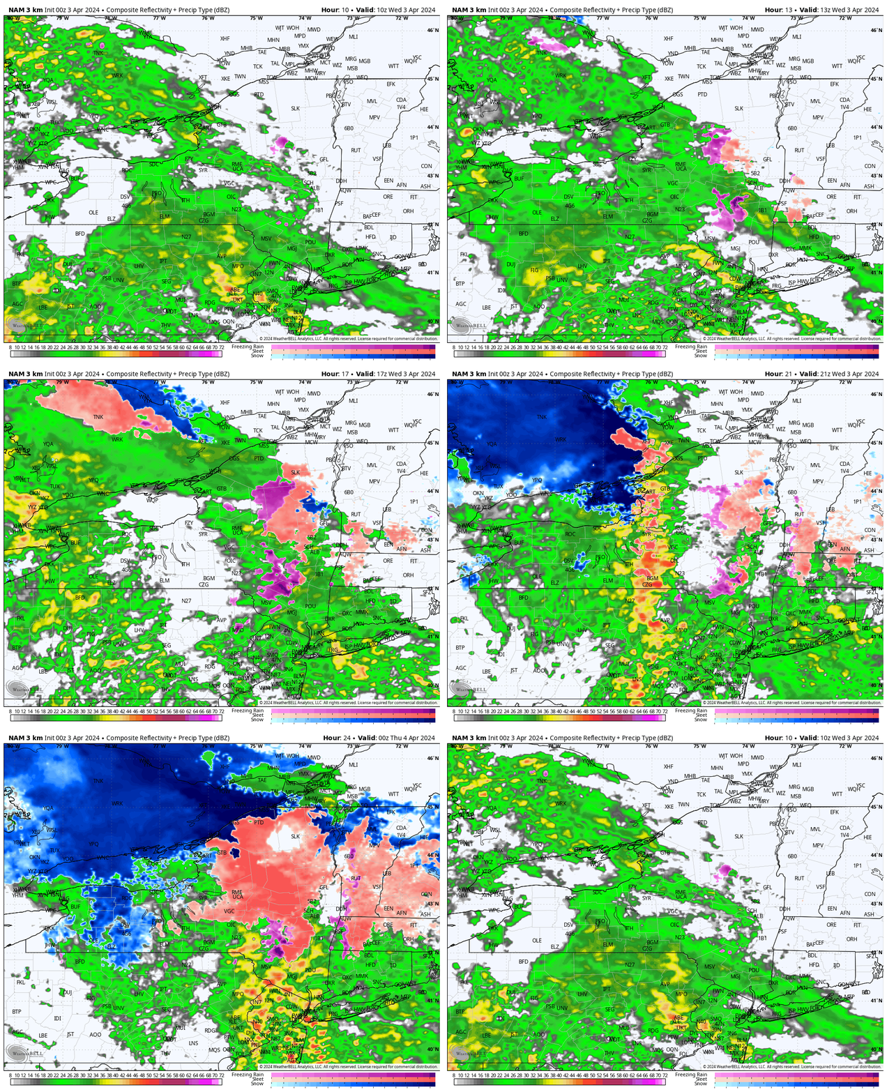
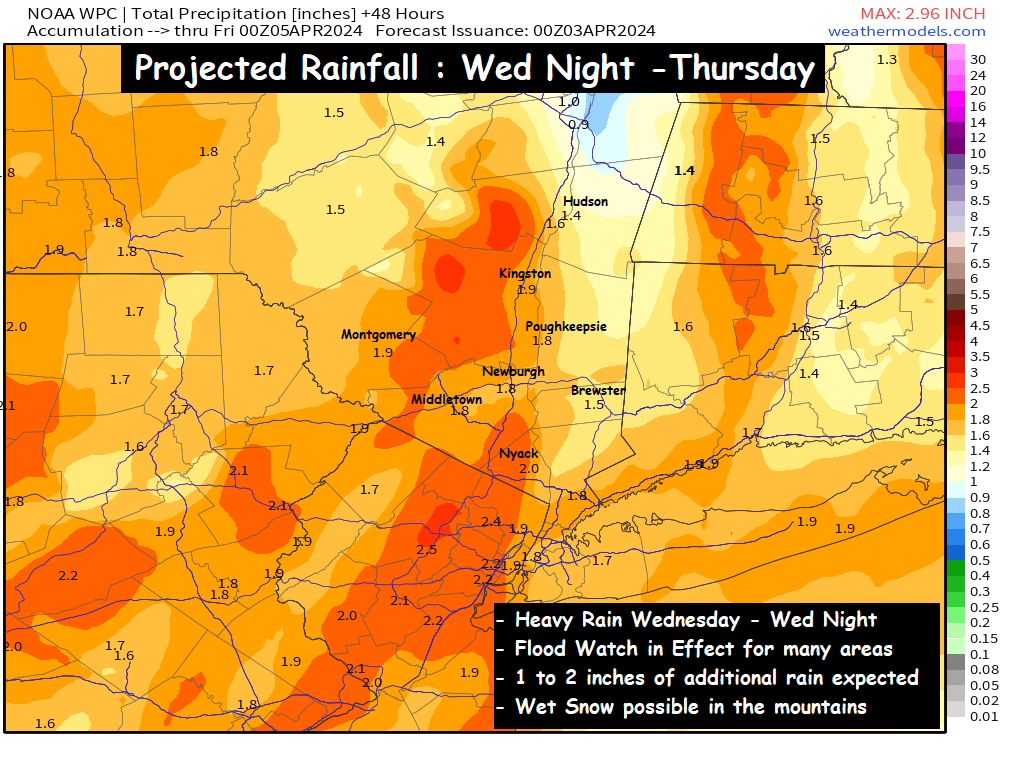
Periods of rain will move in during the morning, and be with us throughout the day. Along with the soaking rainfall, winds will also begin to pick up out of the east ahead of the frontal boundary. While some computer guidance projects wind gusts over 50mph, the good news is that a temperature inversion in the mid levels should prevent the strongest wind gusts from reaching the surface. Even so, a Wind Advisory is in effect for parts of the area, so be sure to plan for a raw, blustery, soaked Wednesday. In addition to Wind Advisories, we have many Flood Watches in effect around the valley, for another 1 to 2 inches of rainfall by Thursday afternoon…
Snow Threat is Gradually diminishing…
For several days, we have been watching for the potential of a coastal low-pressure system intensifying quickly… and causing the rain to end as a period of heavy, wet snow.
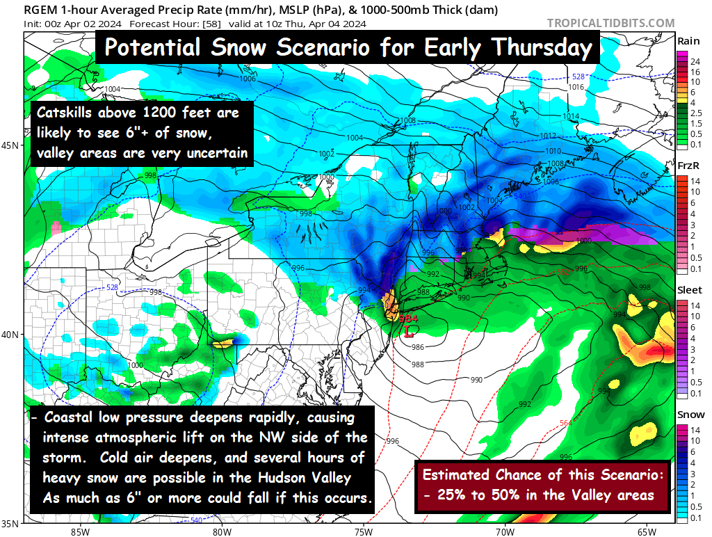
However, as we get closer to the event… we are noticing that temperatures at the mid levels of the atmosphere are just a bit too warm to support snow for many places. So despite surface temperatures in the mid 30s for many locations Wednesday evening… temperatures 5000 feet up are projected to be several degrees above freezing through midnight Wednesday night. By that time, most of the precipitation will have pushed east of the Hudson Valley.
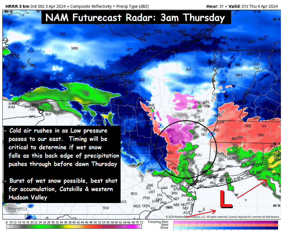
This graphic shows the scenario most likely at this time. You can see the cold air is struggling to rush into the mid levels by 2 or 3am Thursday across the eastern Hudson Valley. The most likely outcome is rain mixing with wet snow in the valley before sunrise… with some areas getting a slushy coating to an inch of wet snow on grassy surfaces. The best chance for accumulation over 1 or 2 inches would be in the Catskills above 1200 feet.
It’s going to be a very tricky situation in terms of the outcome. The calendar reading April 3rd is a major factor against the idea of snow, so we need a cold invasion of air from Canada to allow it to snow. While that cold air does arrive Thursday morning… by the time it does, the precipitation has likely exited. So we’ll monitor the situation as it develops on Wednesday, and if it appears more likely to snow in some areas… we’ll share that information. Otherwise, it’s probably a safe bet to plan for a sloppy and raw Thursday AM commute, that could feature a few slick spots. This way you can adapt either way, depending on how the details shake out.
Be sure to check back for more updates later in the day on Wednesday… Have a great Wednesday… bundle up and stay dry!
-Bill