After a dry start to the work week, things will turn rainy and raw for our Tuesday.
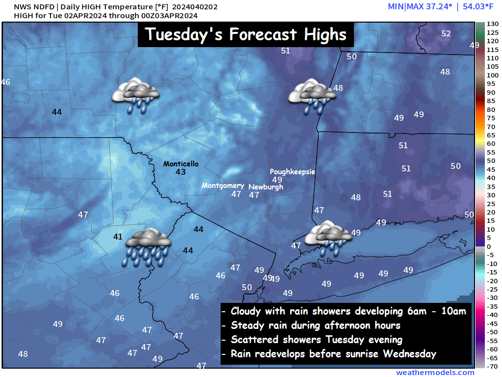
Rain showers will develop during the morning hours and expand in coverage and intensity during the day. The morning commute looks rather dry, but that will change by mid morning across the region.
Futurecast Radar : 6am Tuesday – 12am Wednesday
Temperatures in the valley are expected to linger in the low to mid 40s all day. Make sure you keep a coat and umbrella handy for your Tuesday, as roughly an inch of rain is expected between now and sunrise on Wednesday…
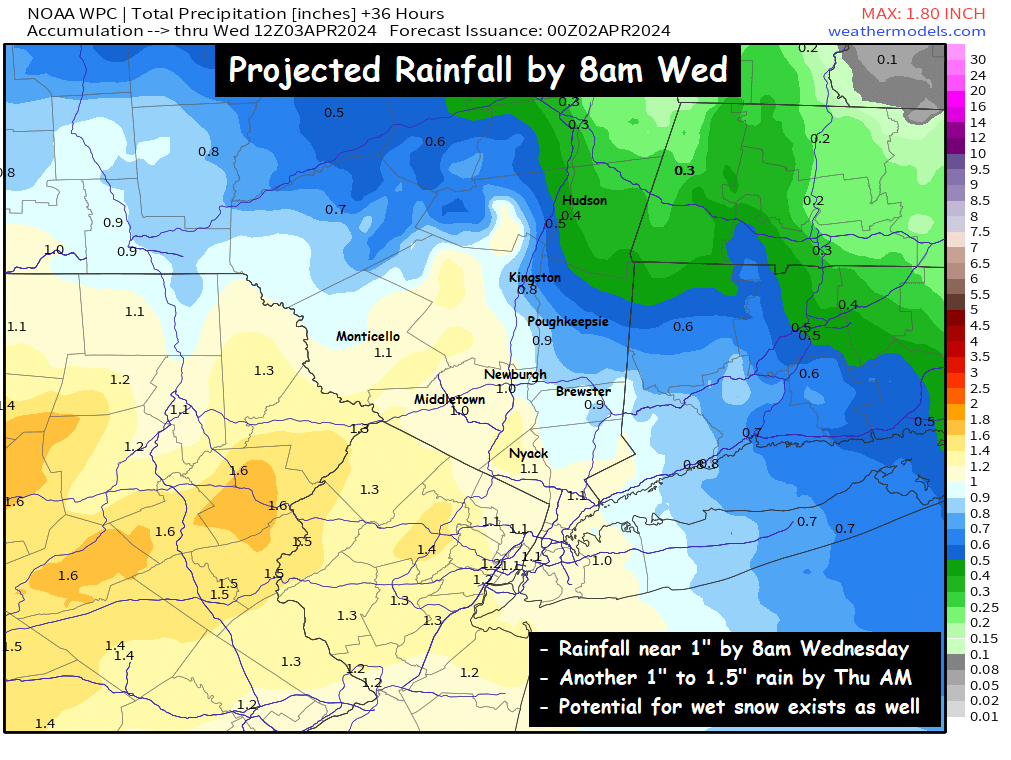
Wednesday looks a lot like Tuesday… with periods of rain expected. Another inch of rain is expected between 8am Wednesday and 8am Thursday (on top of the 1 inch of rain expected Tuesday into Wed AM). The big question that becomes interesting on Wednesday… will be just how cold do the temperatures get across the region? Most of the guidance gives us a cold rain on Wednesday, but afternoon temperatures are likely held down in the 30s!
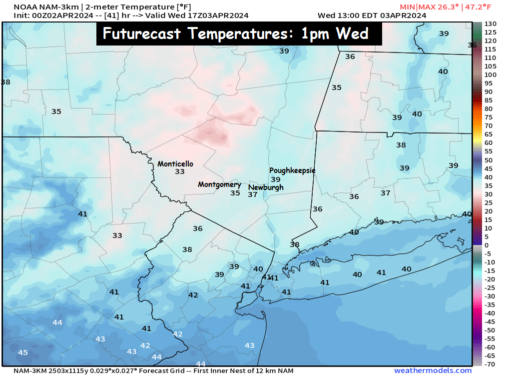
The key will be with regard to the details. Some guidance like the HRRR (and even the NAM) has a combination of rain mixing with sleet during the afternoon hours on Wednesday. Those falling temperatures will mean everything with regard to the details of what kind of weather we see Wednesday night into Thursday.

The HRRR futurecast is aggressive with the southward push of the sleet on Wednesday afternoon and evening… which is an ominous signal for Wednesday night into Thursday.
What is going to happen Wednesday Night – Thursday???
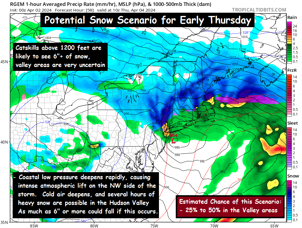
At this time, it truly is a bit of a toss up on how things unfold. Temperatures are going to be so close to freezing… that it will likely depend on how rapidly the coastal low pressure intensifies Wednesday night. If the coastal low begins to bomb out and intensify quickly… it could develop an area of heavy precipitation, that with the atmospheric temperature profile so marginal… we could see a burst of 3 to 6 hours of heavy, wet snow across parts of the region between midnight and sunrise on Thursday morning. It’s also possible that the early April temps are just too warm to support snow, and a wintry mix of slushy snow and rain fall. The details will continue to be worked out slowly on Tuesday. No matter what… an ugly week of weather lies ahead. Check back for updates as we get closer…
-Bill