A frontal boundary slowly pushing east has brought clouds and scattered showers to the Hudson Valley. Many areas saw a period of moderate to heavy rain showers late Wednesday afternoon as a result. That boundary will slowly push east, and a low-pressure system will develop in the Southeast US on Wednesday night and move NE early on Thursday. This could spread a period of steady rain into the lower Hudson Valley before sunrise on Thursday.
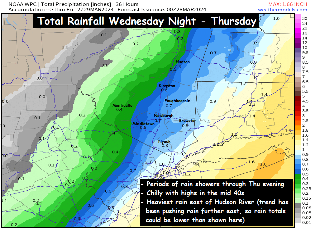
The map shown depicts rainfall totals by Thursday night, and you can see where the heavier rainfall totals are projected to be. The best chance for periods of rain will be areas south of I-84, as well as areas east of the Hudson River (the southeastern half of the valley). The further north and west you go, the fewer rain showers are expected… and so the lower rainfall totals as well.
The recent trend in data has been to push the rain showers on Thursday a bit further to the east… which if correct, will mean less rainfall for all of us on Thursday, and more of a cloudy and damp day instead. We’ll see how it unfolds as the coastal low pressure moves northeast on Thursday. Either way, a damp, cool (mid 40s for highs) and cloudy day is on tap for Thursday.
Weekend Preview :
Fri: Mix of clouds & sun, highs in mid to upper 40s
Sat: Partly cloudy, highs upper 40s to low 50s
Sun: Clouds & sun, high in low to mid 50s.
Stay Dry on Thursday, Hudson Valley!
-Bill