A beautiful start to the work week, at least by mid March standards.
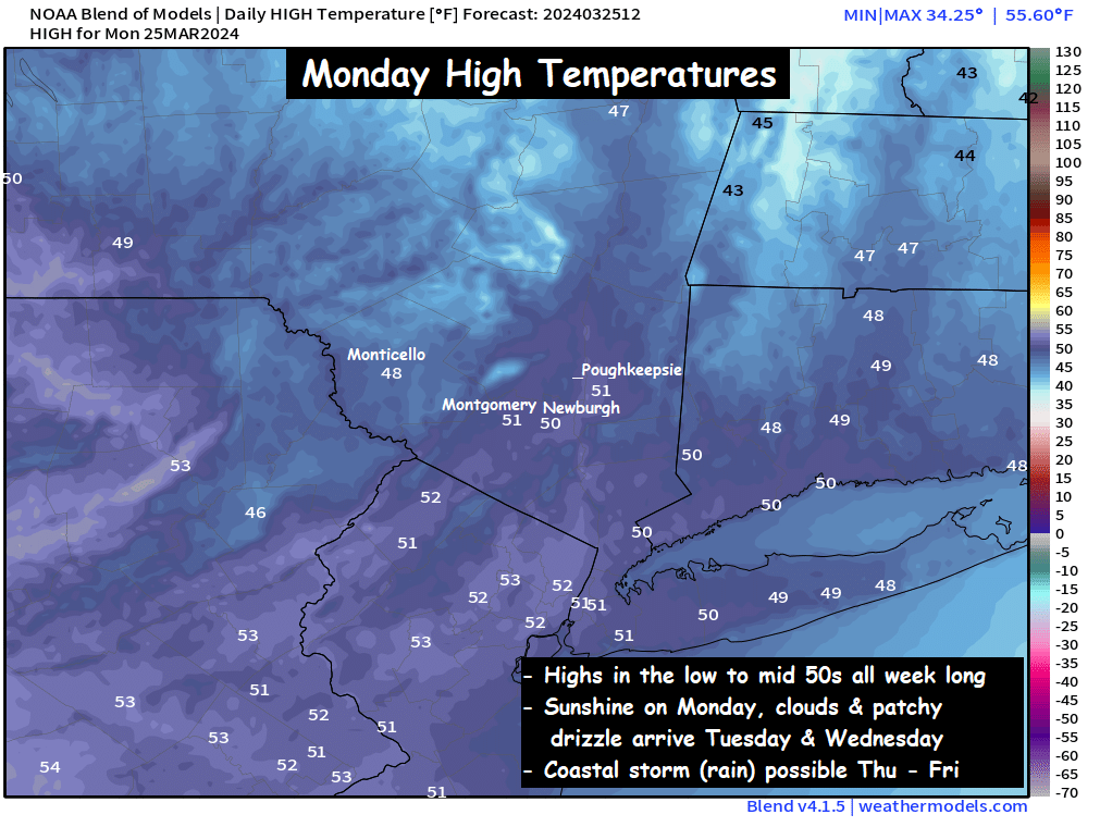
Abundant sunshine and blue skies along with seasonable temperatures in the low to mid 50s will feel quite nice to kick off our week. But a blocking pattern will allow for moisture off the Atlantic Ocean to spread clouds and mid level moisture that could kick off some patchy light showers and drizzle Tuesday afternoon and Wednesday across the Hudson Valley. This will by no means be a washout, but it will keep the skies mostly cloudy Tuesday afternoon and Wednesday. Highs all 3 days should be in the low to mid 50s… with Wednesday being the mildest of the 3.
Then as a cold front reaches the coast by Thursday, a low pressure system is likely to develop in the Southeast US along the boundary. That low will push northeast, up the coastline, and could spread rain showers into the Hudson Valley and northeast Thursday afternoon and Friday. The position of the boundary will be key to determining the track of the storm, so we’ll watch it closely. The best chances for rain will be closer to the coast… as much of the guidance keeps the low pressure a bit offshore. But it’s something we’ll need to watch closely through the week. To be clear, this coastal storm would be all rain, except for the Catskills… as temperatures Thursday and Friday are projected to be in the upper 40s to low 50s.
We’ll have more discussions on the weather through the week. Have a great start to your week, Hudson Valley!
-Bill
Thank you Bill for such a cozy style weather report. I like the way you lay out the the weather.