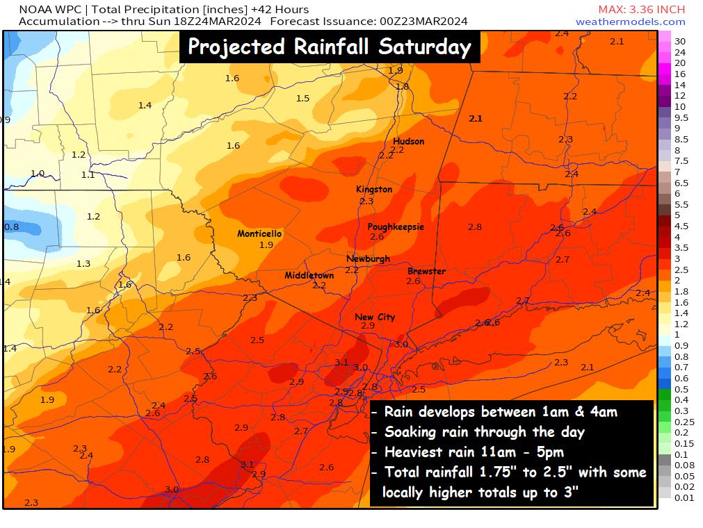
A cold, raw day is in store for the Hudson Valley on Saturday. Rain will develop before sunrise, and fall steadily throughout the day. By the time the storm exits late on Saturday, a general 2 to 2.5 inches of rain are possible across the region.
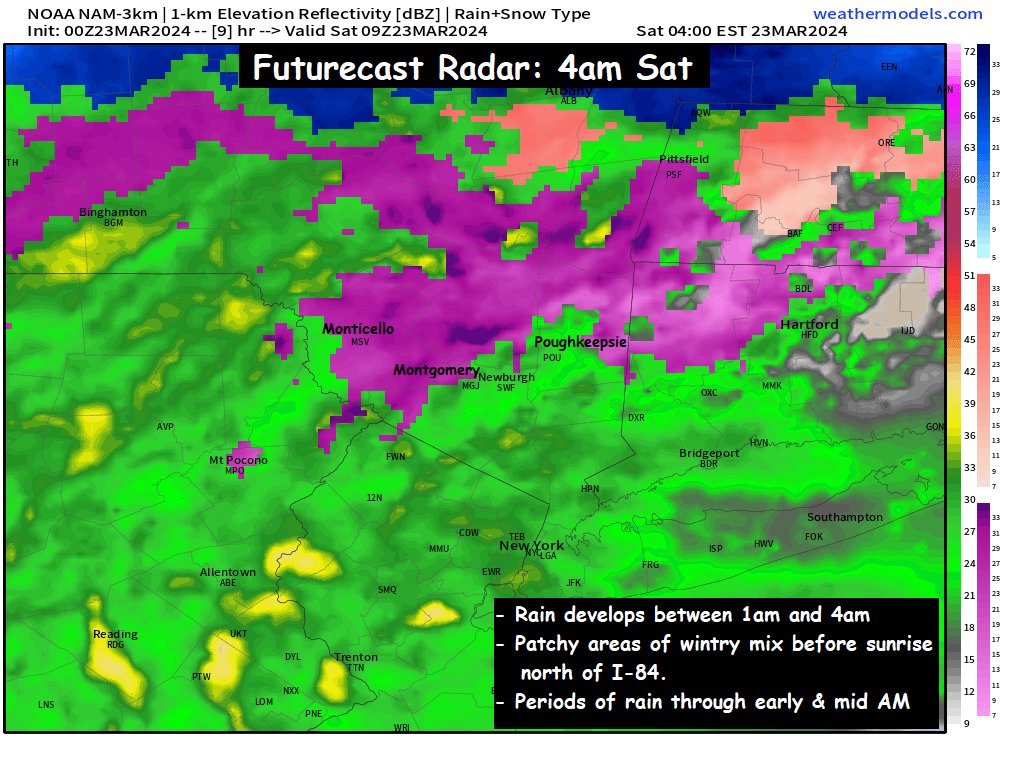
As the rain develops between 1am and 4am… temperatures are projected to be in the low to mid 30s. It’s possible that some pockets of freezing rain and sleet could develop in that timeframe. But by sunrise, we do expect all precipitation to change over to a cold, plain rain.
Temperatures on Saturday will likely hold in the mid 30s to low 40s around the region, making for a very raw and nasty day across the region. The periods of rain will become steadier and heavier as we go through the day. By early afternoon, most of the region should be experiencing a steady moderate to heavy rain.
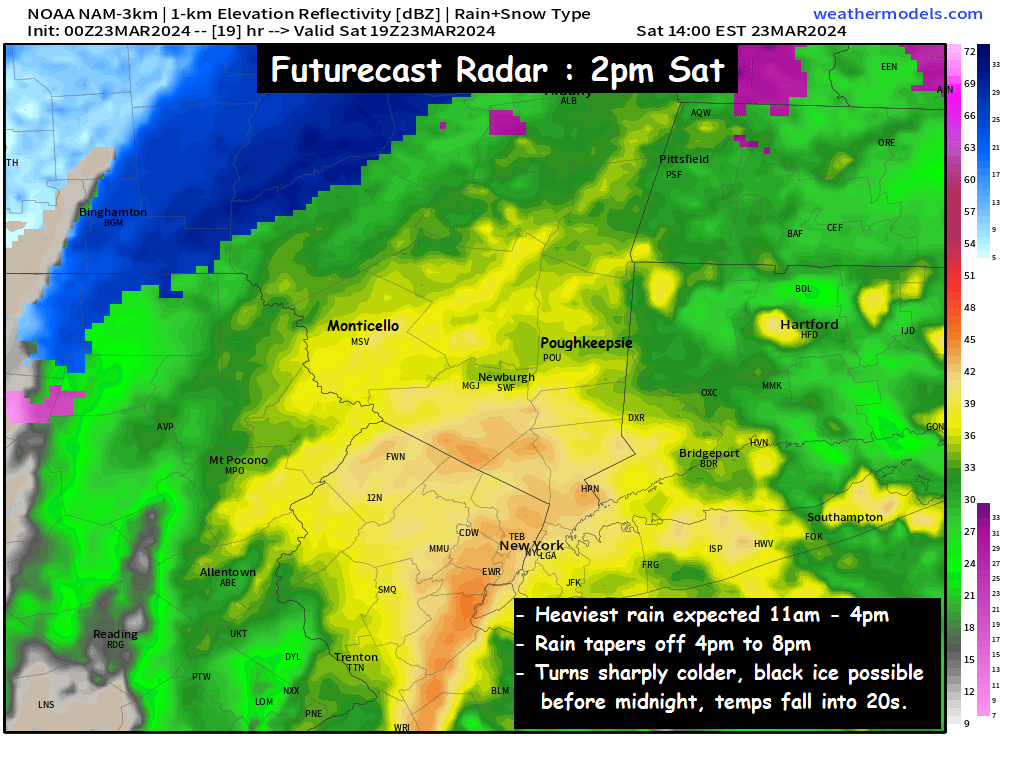
The rain should taper off from SW to NE between 4pm and 8pm, as the low pressure passes by to our SE. Once the low pressure passes by, cold air will quickly return to the valley, and temperatures will tumble back into the 20s and low 30s by midnight. Some areas of black ice are possible, depending on how much time passes between the end of the rain, and the air temps falling below freezing. By Sunday morning, it will feel like winter once again…
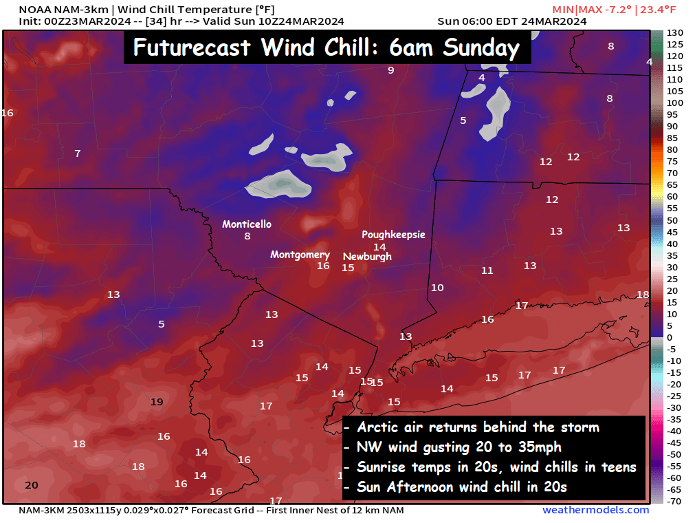
Temperatures will be in the low to mid 20s on Sunday morning… but NW winds gusting over 20mph at times should make for “real feel” wind chills in the teens and even some single digits. Make sure you’re ready for a quick return to winter’s chill behind this storm system.
We’ll have updates on the storm through the day on Saturday…
-Bill
homemade soup day!
In like a lion…
Sounds lovely
Thank You.