The first half of March across the Hudson Valley was extremely warm. We were roughly 10 degrees above average through mid month. But with the passage of an arctic cold front on Wednesday, just like that… winter has returned with a vengeance.
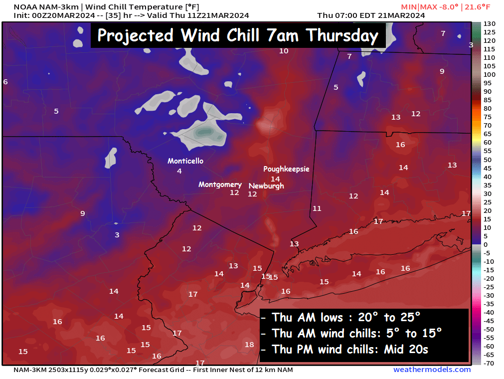
Be sure to bundle up those kiddos before you send them on their way out to the school bus stop on Thursday. Because NW winds gusting 20mph to 30mph will combine with temperatures in the mid 20s early Thursday morning to give us wind chills in the single digits and teens for the AM commute. The winds continue to gust through the day, keeping the chill locked into the region through the afternoon. Afternoon highs in the mid 30s will never feel that warm, thanks to persistent NW gusts. Wind chills at the warmest part of the day are expected to be in the mid 20s… making it feel like the middle of winter, just in time for the 2nd day of spring.

Conditions will moderate a bit on Friday, with winds shifting out of the south. Highs on Friday should reach into the low and mid 40s, which is still below average for this time of year. Then our eyes turn to Friday night and Saturday, as two pieces of energy meet up along the east coast. A short wave approaches from the west, while a coastal low pressure develops along the Carolinas by sunrise on Saturday. This will cause rain to develop and overspread the entire region early in the morning on Saturday. The rain then continues through the day on Saturday, and the afternoon looks very soggy, with periods of rain and temperatures in the low to mid 40s. Unfortunately, our snow lovers will be left out in the cold rain once again… a common theme this winter.
We’ll have more updates on the weekend’s weather as we get closer. Bundle up and have a great Thursday.
-Bill
Your weather insights are greatly appreciated!
Thank you for the info!
WHY ARE THERE SO MANY HATERS IN THE COMMENTS ON THIS WONDERFUL SITE??
THANKS FOR THE REPORTING UNFORTUNATELY NOT THE INFORMATION /