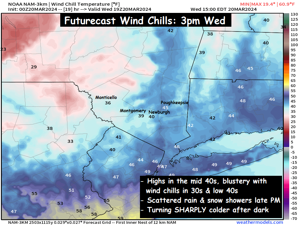
Colder air has pushed into the Hudson Valley, but some even colder air is on the way. We’ll see a mix of clouds and sunshine on Wednesday, with highs in the low to mid 40s. SW winds gusting 10 to 20mph during the day will give us wind chills in the 30s and low 40s.
But this is out ahead of an approaching arctic cold front. The front should reach the Hudson Valley between 3pm and 7pm, and it will bring some scattered valley rain showers, along with mountain snow showers. But as the arctic front passes, snow squalls could reach even into the valley areas near sunset.
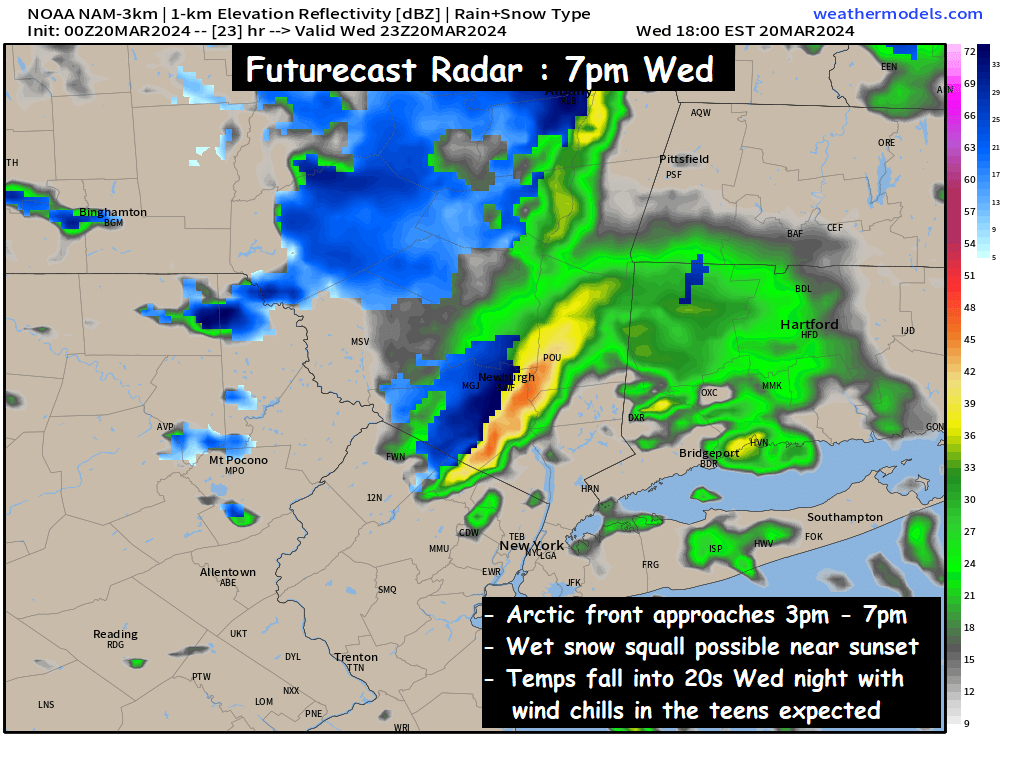
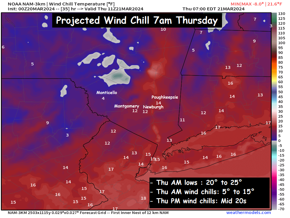
This could make for some tricky PM commuting on Wednesday. Something we’ll try to monitor through the day. But you should expect some scattered rain and wet snow showers late Wednesday afternoon and evening… followed by rapidly falling temperatures and frigid wind chills. Low temperatures Wednesday night should fall into the low and mid 20s… with wind chills in the low to mid teens. Make sure you prepare accordingly.
Spring may have started on Tuesday… but it’s going to feel very much like winter for the next few days.